Disclosure Sponsored Links: This post contains a paid-for sponsored link, meaning we have received compensation in exchange for including it. Sponsorship does not influence our content, but we believe in transparency regarding paid placements.
Due to the rapidly changing world, aerial 3D rendering and visualisation have become essential in various industries. Professionals in urban planning, architecture, real estate, and environmental conservation have started to rely on advanced aerial view rendering and visualisation technologies to redefine how we perceive and interact with our surroundings, obtain deeper insights, and make informed decisions.
Furthermore, aerial 3D renders unparalleled perspectives and life-like representations of landscapes with numerous benefits and practical applications that transform how we approach different fields. Read on.
Table of Contents
Advantages of Aerial 3D Rendering and visualisation
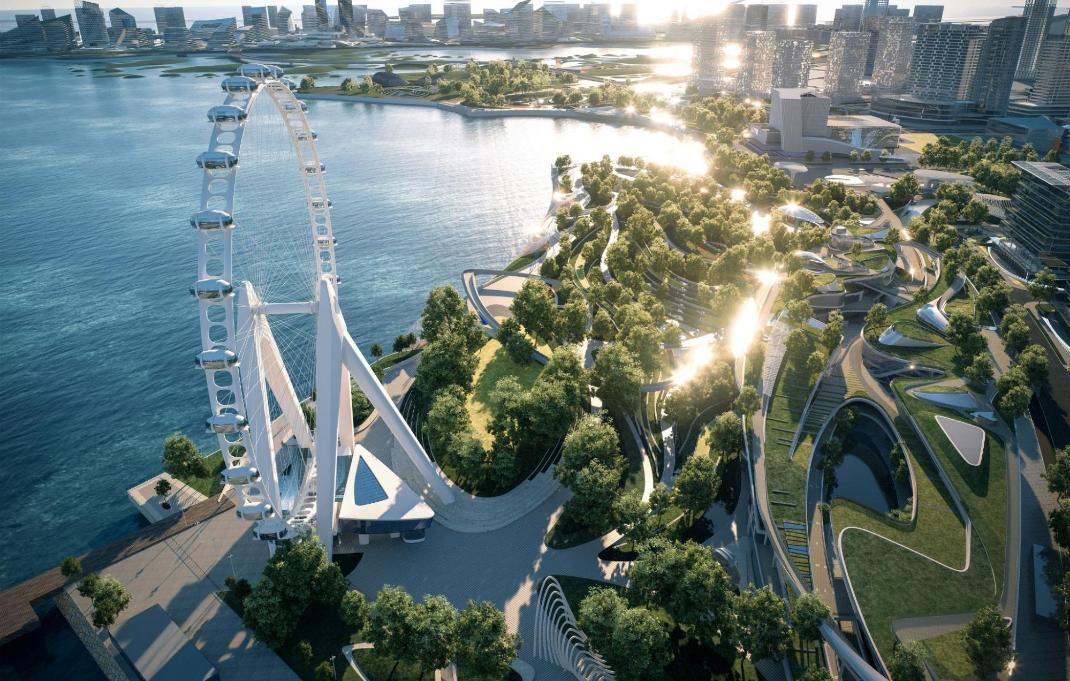
Aerial view rendering and visualisation help provide a more comprehensive perspective of landscapes, as traditional 2D maps or photos are often insufficient in capturing the full complexity of terrain and spatial relationships. However, viewers can explore landscapes from multiple angles with aerial 3D visualisation to comprehensively understand topography and geographical features for informed decisions, whether assessing the suitability of a building site or planning the layout of a new urban development.
Aerial view rendering and visualisation provide a realism level that cannot be achieved by conventional methods via a lifelike portrayal of environments by simulating lighting conditions and incorporating intricate details such as vegetation and terrain textures. Architects and urban planners can also use this realistic representation to communicate design concepts effectively to allow stakeholders to visualise projects before they are built. This enhances communication and collaboration and reduces the likelihood of misunderstandings or costly revisions.
3D aerial view rendering services offer tangible benefits in terms of time and cost efficiency. Traditionally, conducting site visits for planning and assessment purposes can be time-consuming and resource-intensive. However, with aerial 3D visualisation, stakeholders can virtually explore landscapes from the comfort of their offices, saving both time and travel expenses. Identifying potential issues or conflicts early in planning can help streamline workflows and minimise costly delays during construction or development.
3D visualisation also contributes to safety and risk mitigation. For instance, stakeholders can identify potential hazards and mitigate risks proactively by conducting virtual inspections of sites before physical construction begins. As a result, workers and the environment are protected, and costly accidents or legal liabilities are avoided. An aerial view rendering studio can help develop emergency response plans and improve overall project resilience by simulating various scenarios, such as natural disasters or structural failures.
Practical Applications of Aerial 3D Rendering and Visualisation
Aerial view rendering and visualisation are utilised in various industries and have distinct benefits. In urban planning and development, officials and architects use them to create and visualise infrastructure projects, such as roads, bridges, and public spaces. By forecasting the effects of proposed developments on the surrounding environment, stakeholders can also make informed decisions that promote sustainable growth and improve the quality of life for residents.
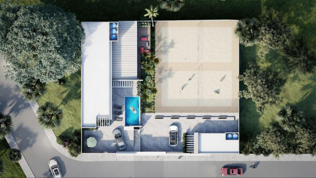
In architecture and construction, aerial 3D visualisation has changed how buildings are designed, constructed, and marketed. For instance, architects use these visualisations to communicate design concepts to clients and stakeholders, reducing the need for costly revisions and facilitating better decision-making. Meanwhile, construction companies can use aerial 3D visualisation to optimise construction processes, increase efficiency, and ensure compliance with safety standards.
Aerial 3D visualisation also benefits the real estate and property management industry. Real estate agents use immersive virtual tours of properties to attract more buyers and renters, thereby speeding up sales cycles and increasing revenue. Furthermore, developers and property managers can use aerial 3D visualisation to assess property value, evaluate land use opportunities, and identify areas for improvement or redevelopment.
Thus, aerial 3D visualisation is critical in environmental conservation efforts, as it enables scientists and researchers to monitor and manage natural habitats and ecosystems. Thus, these visualisations offer valuable insights that inform conservation strategies and policy decisions by studying the effects of climate change and human activity on landscapes and tracking changes in vegetation patterns. Stakeholders can work together to find solutions that balance economic growth with environmental sustainability by using visualisations to show the impact of proposed development projects on sensitive ecosystems.
Final Words
Aerial 3D rendering and visualisation are valuable tools that can help us gain deeper insights into our surroundings for informed decision-making across various industries. As such, the ability of 3D aerial view rendering services to offer enhanced perspectives, realistic representations, and tangible benefits in time, cost, and safety makes them essential in today’s various industries. The potential applications of aerial 3D visualisation are limitless and can only be limited by our imagination as technology improves and innovations emerge. So, the sky is indeed the limit to adopting this technology.
Author:
Aimee S. Marshall
Aimee is a seasoned digital artist and design enthusiast who is passionate about creating stunning visuals. With over a decade of experience in 3D rendering and design, she has worked on projects spanning various industries, from architecture and interior design to product visualisation and advertising. Aimee shares her expertise and insights through writing, mentoring, and speaking engagements, aiming to inspire others in the dynamic world of 3D rendering and design.